Skip to content


Blog

Coyote Point Hikes for the Curious Visitor

Written by Emma Hanisch

CuriOdyssey is a great place to visit, but did you know that there are a bunch of other cool spots around Coyote Point where you can discover the natural world? This post covers three places within a 10-15 minute walk of CuriOdyssey’s front gate – each with their own unique features.
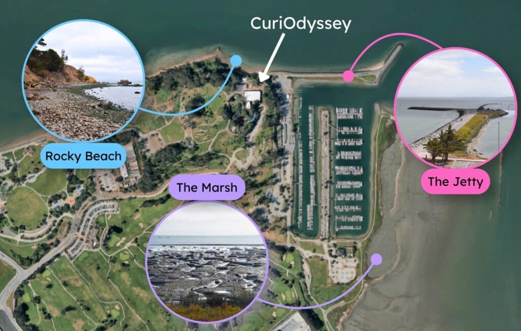
A satellite view of Coyote Point Recreation Area. Three locations are marked with a dot, which connects to a circle showing a photo of the location. The three locations are the Rocky Beach, to the north; the Jetty, to the northeast; and the Marsh, to the southeast. A white arrow points out where CuriOdyssey is, between the three locations.
Satellite image captured from Google Earth

Heads up! High tide can cover these places or make them inaccessible, so check the tides in Coyote Point Marina before you go. 
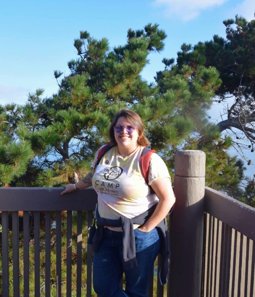
A photo of Emma, a person in a Camp CuriOdyssey t-shirt, jeans, and sunglasses. They have shoulder-length brown hair and are carrying a red backpack. They are standing in front of a railing with one hand on the railing and the other hand in their pocket. There are green pine trees in the background.
Hi! I’m Emma. I spent my summer bringing Camp CuriOdyssey campers to all of these spots to explore, learn and play. All photos were taken by me or my fellow educators, except where otherwise noted. 

The Marsh

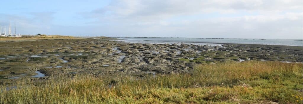
A photo of the salt marsh at Coyote Point. The foreground is green salt grass and pickleweed. The midground is lumps of brown mud with green algae on top, with water in between the lumps. The left side of the background shows sailboats in the marina, and the right side shows the Bay.
This salt marsh is a biodiversity hotspot, especially for shorebirds. It’s also a must-visit for anyone who loves squishing in the mud! 

How to get there:

The Marsh is past the marina and the Yacht Club building, along the Marina Trail and Shoreline Trail. You can enter the higher parts of the Marsh using the small, unpaved trail across from the Yacht Club parking area. It’s marked by a sign, trash can, and bench. 
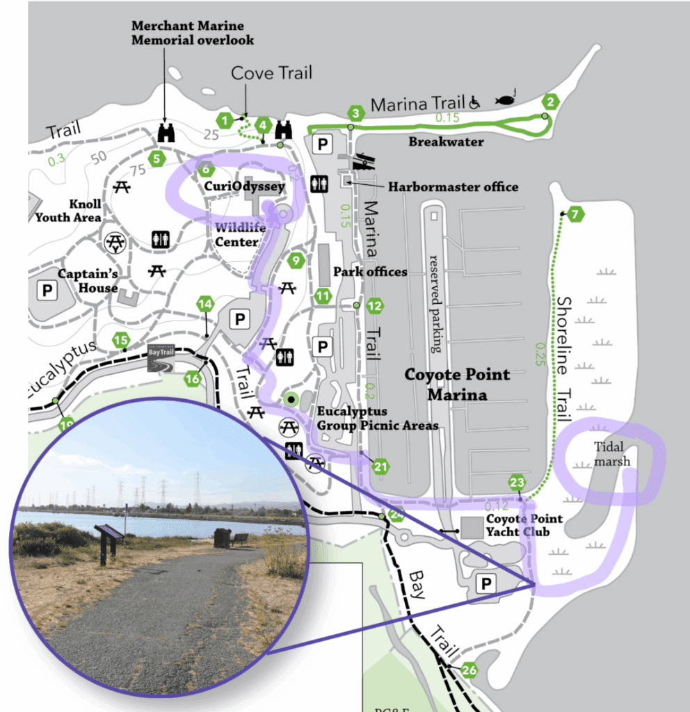
A map of Coyote Point, showing the route from CuriOdyssey to the Marsh highlighted in purple. An inset photo shows a path with a sign, trash can, and bench on the left side of the path.
This path leads to a trail that goes into the Marsh, but you can also continue down the Shoreline Trail for more birdwatching. 

Things to see:

  • Birds: The Marsh provides food for all kinds of birds, including pelicans, egrets, herons, avocets, killdeer, godwits, wimbrels, plovers, and many more. Almost 300 species of birds have been documented at Coyote Point. 
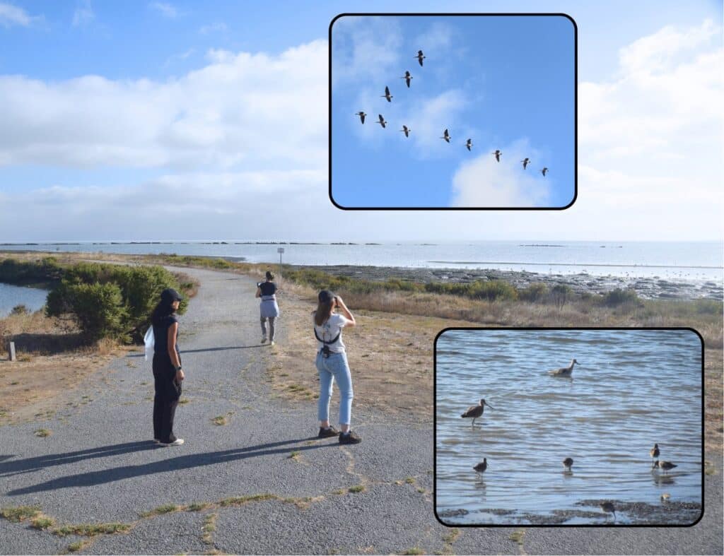
A photo of three people birdwatching at the Marsh, one with binoculars. Their shadows are long in the early morning light. Two inset photos show groups of birds; one shows a flock of geese in a V formation, and the other shows some shorebirds wading in shallow water.
Early morning is a great time to spot birds and other animals. 
  • Tracks: All kinds of wild animals visit the Marsh for food. See if you can spot the tracks of birds, raccoons, or even coyotes in the mud. 
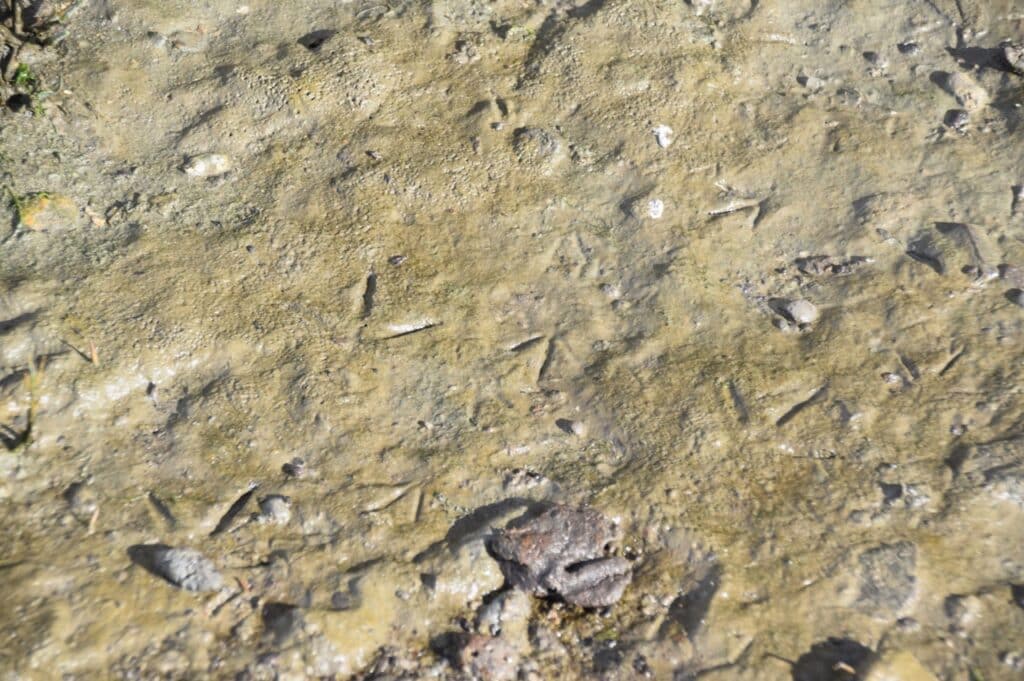
 a close up of some three-toed bird tracks in brown marsh mud. The mud is also dotted with pebbles.
The sticky mud captures footprints perfectly. 
  • Salt-adapted plants: Pickleweed and salt grass grow all around the marsh, and they get their water from the salty bay. Salt grass secretes the extra salt onto its leaves, and pickleweed stores the salt in its round stems. 
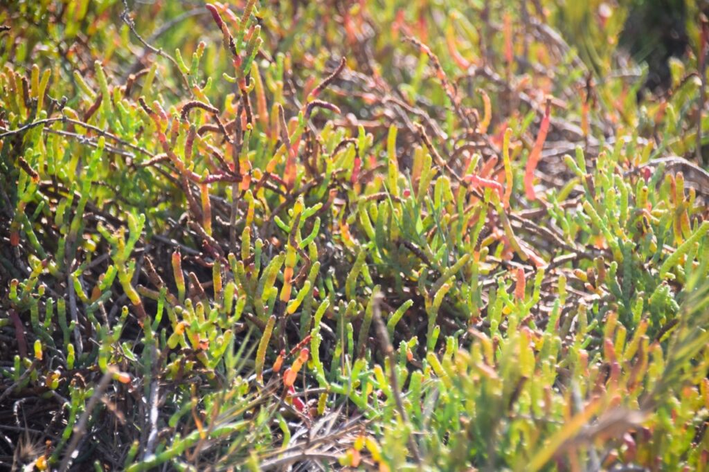
a close-up photo of pickleweed, a marsh plant that grows in bumpy, cylindrical stems. Most of the plants are green, but some have red tips.
When a pickleweed stem has extracted enough salt, it turns red and falls off. This removes excess salt from the rest of the plant. 

Marsh science:

  • Coyote Point is a stop on the Great Pacific Flyway – the seasonal migration route that birds follow up and down the West Coast. It takes a lot of energy to fly hundreds of miles, so many birds stop at wetlands like the Marsh to eat and rest. 
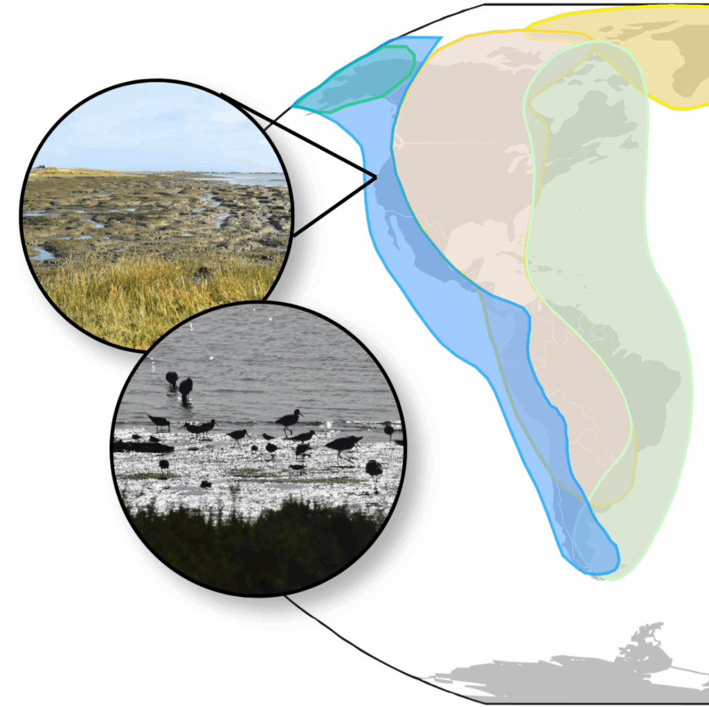
A map of North and South America, with regions highlighted to show three different migratory paths for birds. The Pacific Flyway, the western region, is in blue. An inset photo out where Coyote Point’s Marsh is, and another shows shorebirds silhouetted against the water.
The Pacific Flyway is highlighted in blue. Map by Pinpin via Wikimedia Commons (CC BY-SA 3.0)
  • Salt marshes form where sediments collect, often near where rivers meet the sea. Coyote Point used to be an island, and the (relatively) calm waters around it built up mounds of mud on all sides. Much of the historic marsh was filled in for farmland in the late 1800s. 
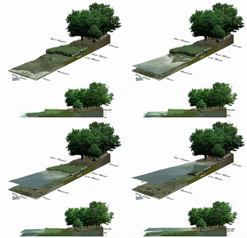
An animated diagram showing how a salt marsh floods in high tide. Water covers the mud flats, then the small plants, and finally reaches the trees.
High tide floods the Marsh twice a day. Image from NOAA via Wikimedia Commons (public domain)
  • The Marsh is home to two endemic animal species: the salt marsh harvest mouse and the San Francisco garter snake. These animals only live in the South Bay Area and nowhere else in the world. 
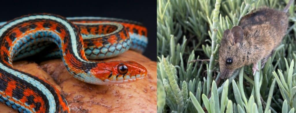
Two photos, one showing the San Francisco garter snake and the other showing the salt marsh harvest mouse. The snake is red with a white stripe and belly and black markings. The mouse is brown and climbing through green pickleweed.
San Francisco garter snake by mgkuijpers via Adobe Stock; Salt marsh harvest mouse by Rachel Tertes/USFWS via Wikimedia Commons (public domain)

Know before you go:

  • The Marsh is full of sticky, slippery, deep mud, so wear shoes that can get muddy and that will stay on your feet. If you venture off the path, step carefully to test the ground before you put your weight there. 
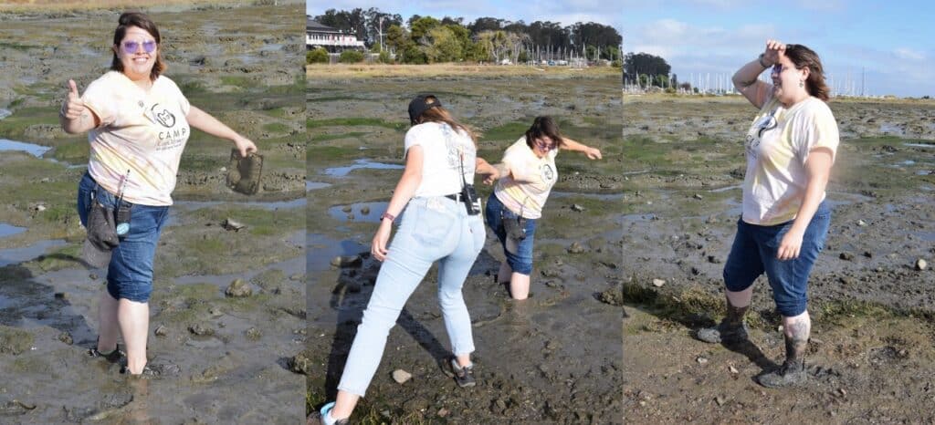
Three photos of Emma in the Marsh. The first one shows Emma standing ankle deep in mud with pants rolled up, holding a piece of litter and giving a big thumbs up. In the second picture, another person is helping Emma get out of the mud, which is now calf-deep. The third photo shows Emma wiping their forehead in relief, now on solid ground but with mud covering their feet and lower legs.
Caption: Exploring the mud is lots of fun, but go with a friend and hang on tight to your shoes! The mud will rinse off your skin with water.
  • The path leading from the paved trail into the Marsh is narrow and uneven.
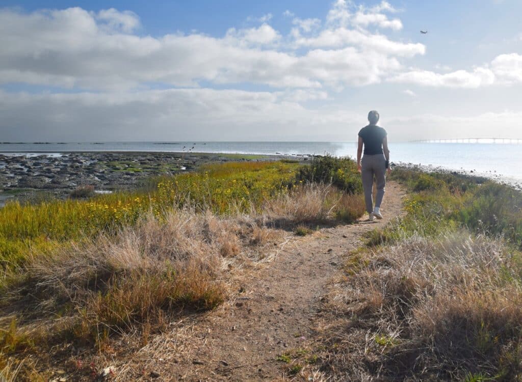
A person walking into the Marsh on the access trail. The trail is made of gravel and is just wide enough for one person to walk, with plants on either side. The Marsh is to the left of the trail, and the Bay is to the right of the trail.
The Marsh access trail goes out onto a long, curved gravel bar.

Want to go to the Marsh with a guide? CuriOdyssey hosts Public Marsh Hikes once a month, outside of summer.

The Rocky Beach
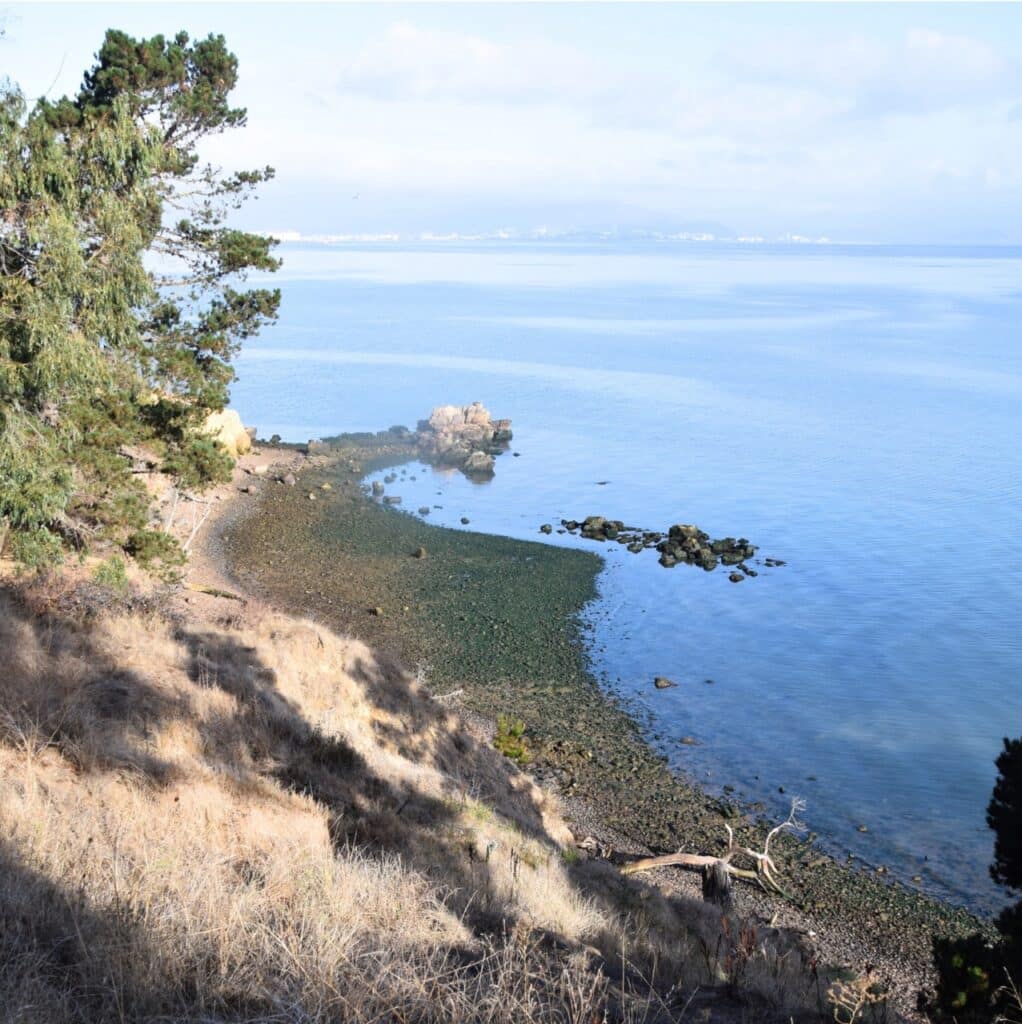
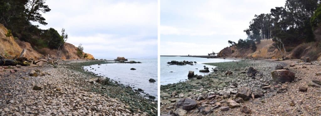
Two photos of the Rocky Beach, looking to the left and the right from the middle of the beach. The ground is covered in stones, some of which are coated in green algae or seaweed. Orange sandy cliffs rise above the beach, and trees grow from the tops of the cliffs.
The Rocky Beach is a great place to explore the intertidal zone (the region between high and low tide), along with the animals and plants that live in this constantly-changing world. 

How to get there:

Head down the Cove Trail behind the Bay Gallery (the blue building at the back of CuriOdyssey). You can also reach Rocky Beach from the parking area by the Jetty or from the right end of the sandy beach near the park entrance. 
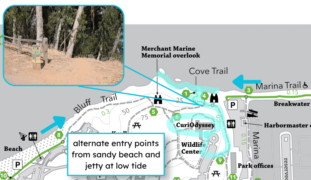
A map of Coyote Point, showing the route from CuriOdyssey to the Rocky Beach, highlighted in light blue. The path goes down the Cove Trail. An inset photo shows the dirt trailhead for the Cove Trail, marked by a post with green and yellow signs. Blue arrows point inward from the main beach and from the marina trail, showing alternate access points. A text box reads, “alternate entry points from sandy beach and jetty at low tide”.
If you want to walk along the whole Rocky Beach from end to end, go at low tide (unless you want to swim around the points).

Things to see:

  • Crabs: These tiny yellow and green shore crabs are all over the place, but you may not see them unless you pick up rocks near the water. Move rocks slowly and gently to see what’s underneath. 
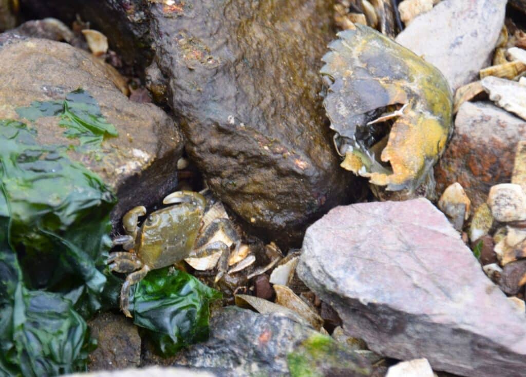
A small greenish crab among some brown rocks with green seaweed on them. A larger crab exoskeleton sits nearby.
Most of these crabs are the size of a quarter or smaller. They shed their exoskeletons (hard outer coverings) as they grow bigger.
  • Intertidal life: Some animals live on rocks that are underwater at high tide, but are exposed at low tide. Barnacles, marine snails, and ocean isopods are adapted for both wet and dry conditions. 
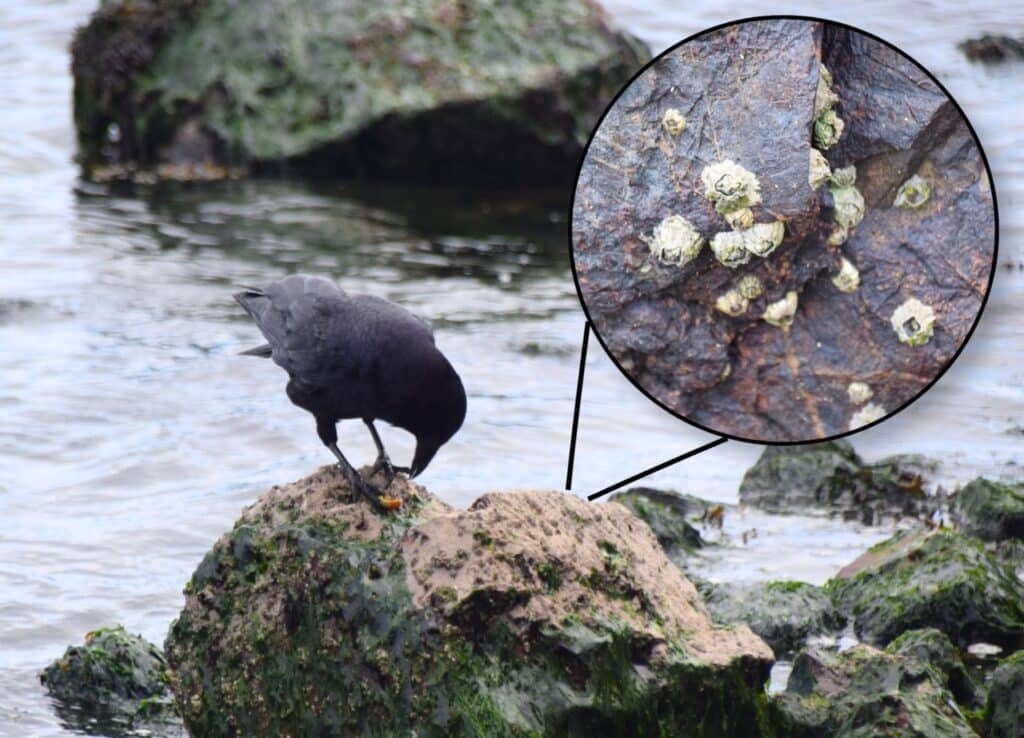
A photo of a crow perched on a rock covered in barnacles and seaweed. The crow is eating an orange snail. An inset photo shows a close-up of some barnacles attached to the rock.
This crow found a tasty treat among all the closed-up barnacles in the intertidal zone: a juicy snail.
  • Colorful rocks: The colors come from mixes of different minerals in the rock, like iron for red, magnesium for green or black, and silica for lighter grays and tans. 
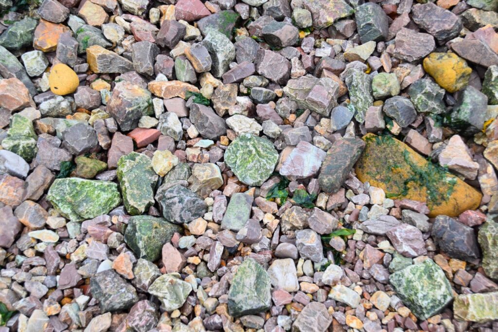
A photo of rocks that make up the Rocky Beach. The rocks are mostly fist-sized, and come in a variety of colors including green, red, yellow, gray, black, and white. Many rocks include multiple colors mottled together.
There are a lot of minerals in this photo, but some of the green also comes from algae or seaweed. The plants can be slippery near the water, so watch your step.

Rocky Beach science:

  • A camper asked me an amazing question this summer: “How did the rocks get here?” I didn’t know the answer, so I read a whole book about it (Building California by John McPhee). Coyote Point is part of the Franciscan Assemblage: a messy formation of different rock types that were mushed together as they collided with North America.
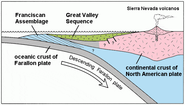
A diagram showing the plate tectonic action that built California’s geology. From the left (west), the Farallon plate in gray is sliding under the North American plate in pink. Between the gray and pink, there is a blue region labeled as the Franciscan Assemblage, and a green region labeled as the Great Valley Sequence. In the pink region, a volcano is rising and is labeled as Sierra Nevada volcanoes. The image shows how the Farallon plate pushed the Franciscan Assemblage and the Great Valley Sequence into place against California’s coast.
Tectonic plate collisions account for most of California’s geology. The one that built the current coastline happened in the age of the dinosaurs. Image by Mikesclark via Wikimedia Commons (CC BY-SA 3.0)
  • Some of the rocks on the beach have washed ashore, but most eroded out of the hillside. The wind and waves strip away softer rock like sandstone, leaving the harder rocks behind. You can see this happening at the yellow sandstone bluff to the left of the Cove Trail. 
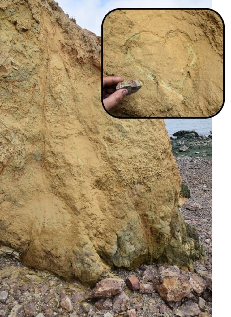
A photo of a yellowy-orange sandstone cliff on the Rocky beach, with a heart etched into it. An inset photo shows a close-up of the heart, with a hand holding a red-and-green mottled rock that was used to etch the heart.
This sandstone is so soft that you can draw on it or carve into it with another rock.
  • People have been visiting Coyote Point for at least 4,000 years. The Ohlone, the original people of the San Francisco Peninsula, use local, native plants for food and medicine. Sticky monkey flower can help treat digestive issues and burns, and laurel leaves provide a natural insect repellent. 
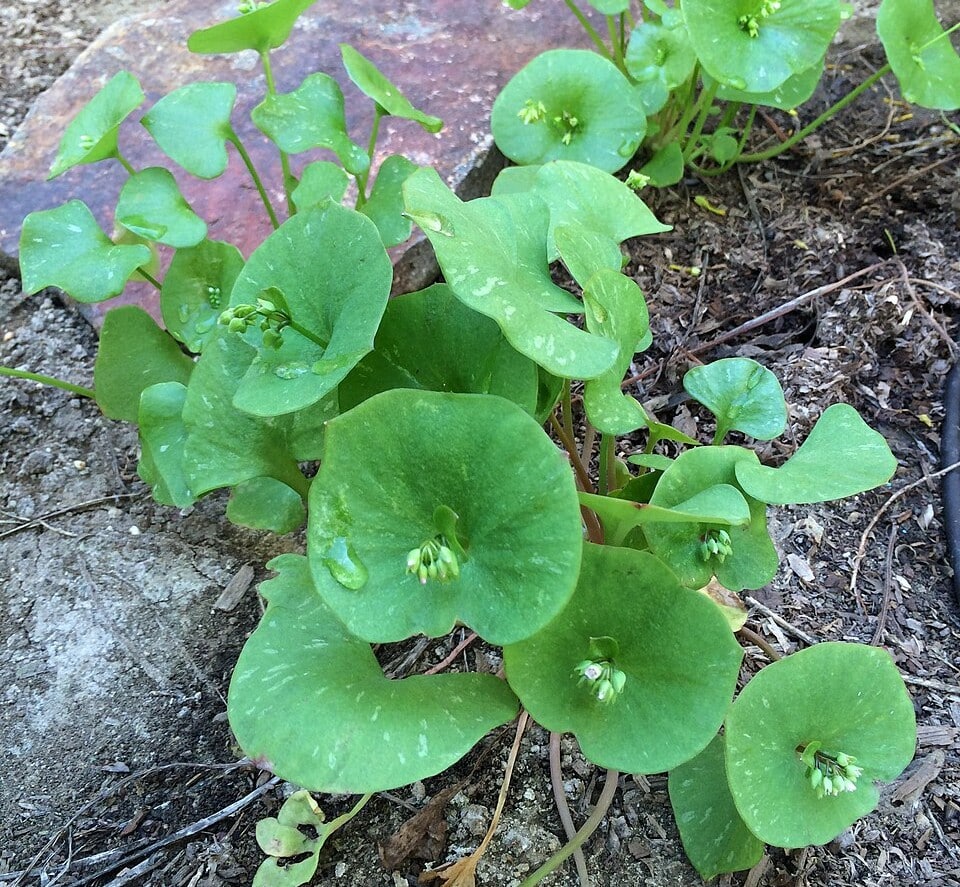
A photo of rooreh, or miner’s lettuce: a bright green plant with round leaves with a group of small white flowers growing out of the middle of the leaf.
Rooreh, or miner’s lettuce, is a tasty herb that provides lots of Vitamin C. Please don’t pick or eat any in the park, though (especially considering all the dogs that walk here). Photo by glmory via Wikimedia Commons (CC0 1.0)

Know before you go:

  • The hillside above the Rocky Beach is home to poison oak, which can give you an itchy rash if you touch it. We leave the poison oak growing on the hill because it’s a native plant, but we clear it off the trail. If you stick to the path, it’s easy to avoid.
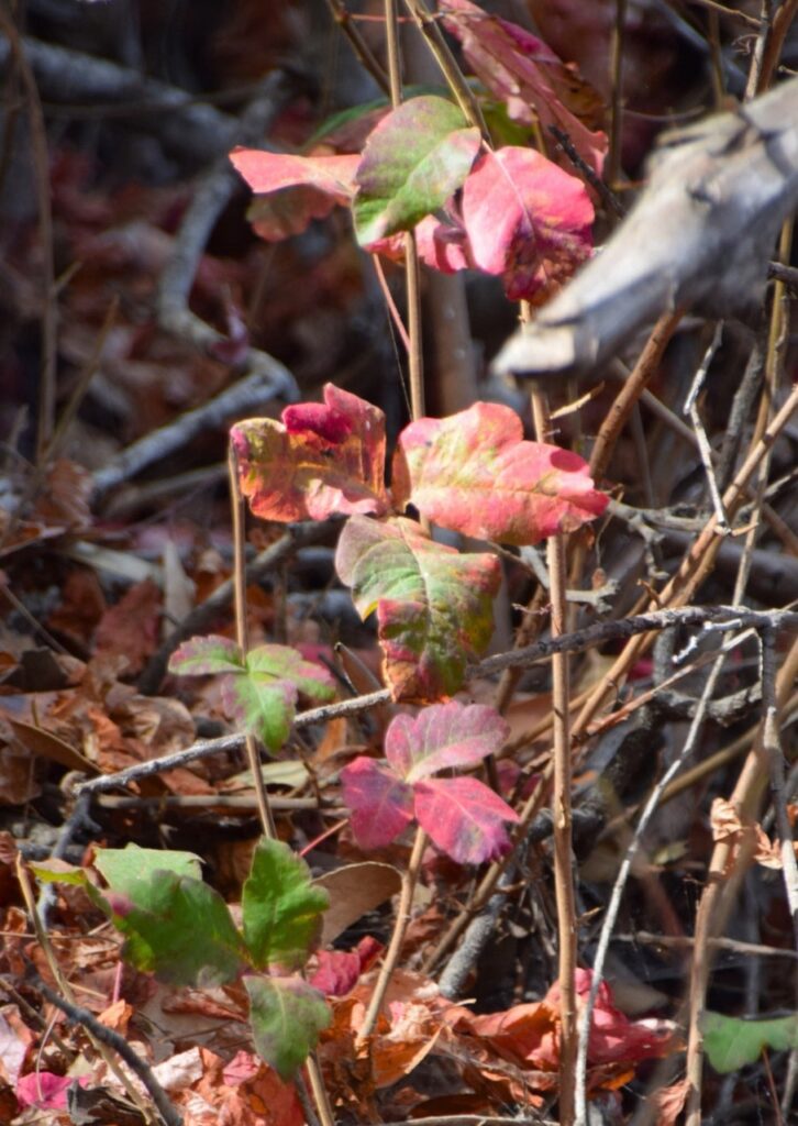
A photo of poison oak, a plant with green and red leaves that are lobed like an oak tree’s leaf. The leaves grow in groups of three.
Poison oak can look different as the seasons change. Learn more about recognizing and treating poison oak here.
  • The Cove Trail is short, but steep and narrow. The lower portion is made of stairs, and there’s a big step down onto a log at the bottom.
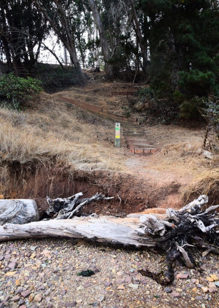
 A photo of the Cove Trail, as seen from the Rocky Beach. The base of the trail is behind a large driftwood log, and it starts with a big step up a small sandy cliff. Above the cliff is a section of gravel trail, leading up to a set of winding wooden stairs. A wooden post with green and yellow signs marks the trail. The trail leads up into a grove of trees.
I usually scoot over the lowest ledge on my bottom.

The Jetty & Shell Beach

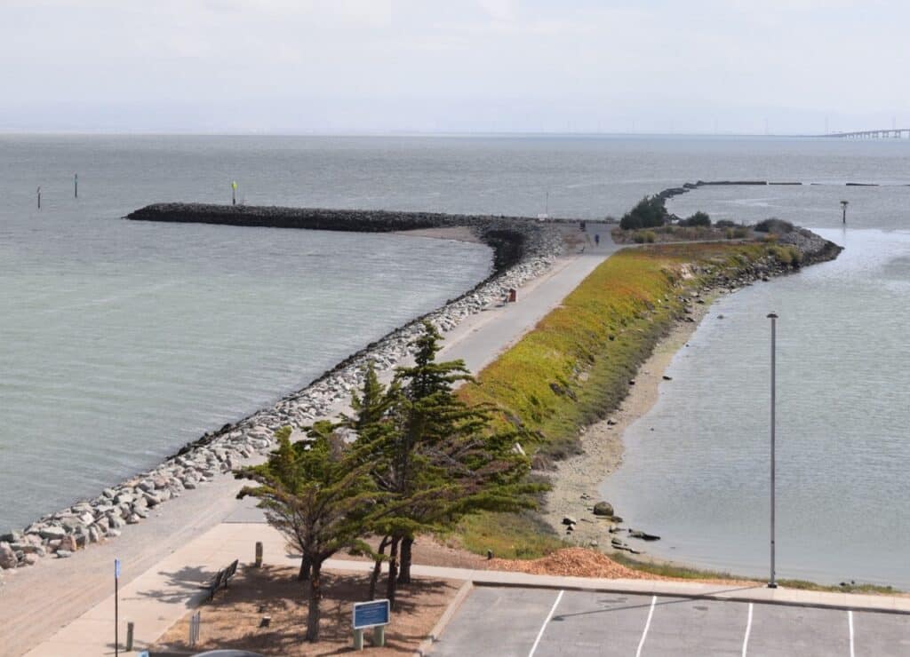
A photo of the jetty from above. The Jetty is a strip of land that sticks out into the Bay, with a paved path going down the middle. The right side of the path is green and descends down to a muddy bank. The left side is made of large boulders. The jetty bends to the left after the trail ends in a loop. The part after the bend is made entirely out of boulders, and also has a small beach just after the bend. There is a parking lot in the foreground on the right.
The jetty offers unparalleled views of the Bay, letting you see (and feel!) the wind and waves in action.

How to get there:

From CuriOdyssey, head down to the marina and go all the way to the left, past the boat launch. The paved Marina Trail leads out onto the Jetty. If you want, you can climb onto the boulders past the end of the trail, either to Shell Beach or to the very end of the Jetty. 
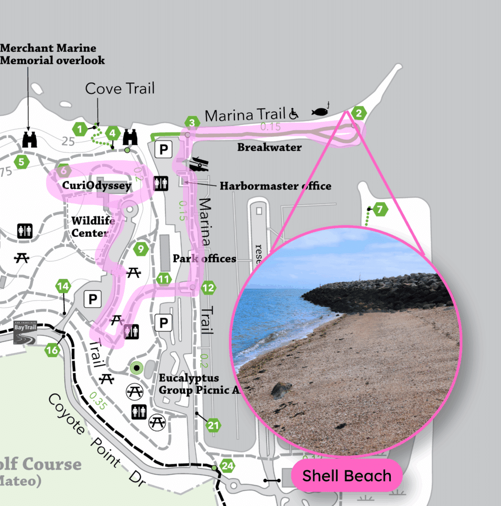
A map of Coyote Point, showing the route from CuriOdyssey to the Jetty highlighted in pink. An inset photo, pointing to the bend in the Jetty, shows part of the Shell Beach.
Here, the Jetty is referred to as the Breakwater. You can also park down by the boat ramp and Harbormaster’s office.

Things to see:

  • Shells and seaglass: The bend in the jetty collects things from the waves, forming a beach. The beach is made almost entirely out of seashells, with a sprinkling of smooth seaglass. 
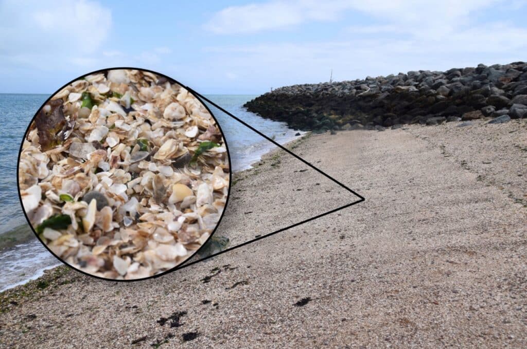
A photo of the Shell Beach, with the Jetty extending in the background and the Bay on the left. An inset photo shows a close-up of the seashells that make up the beach.
The darker rocks of the jetty show how high the tide can get.
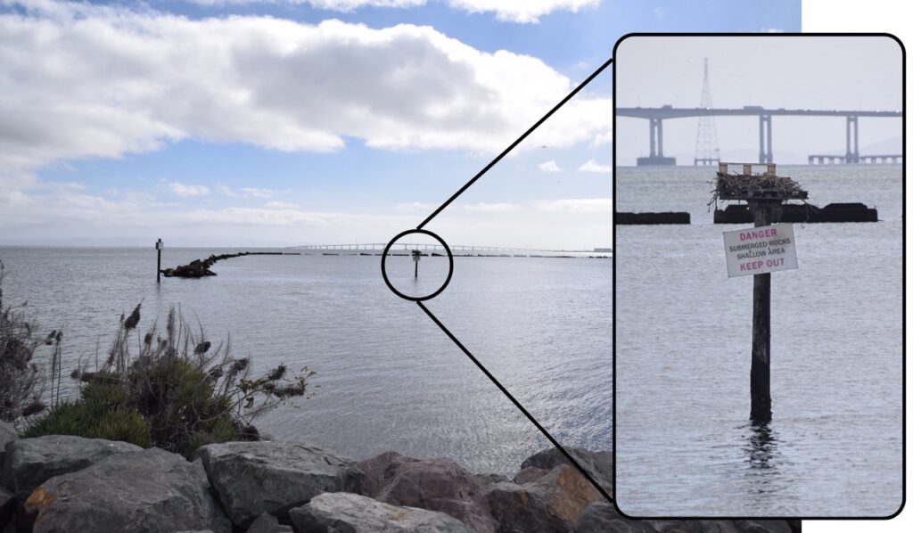
  • Osprey nest: If you look at the channel marker halfway between the Jetty and the spit across the marina, you’ll see a nest made of sticks. Ospreys return to that nest every year, usually arriving in February and leaving in August or September. If you visit in spring or early summer, you might even see a chick! 
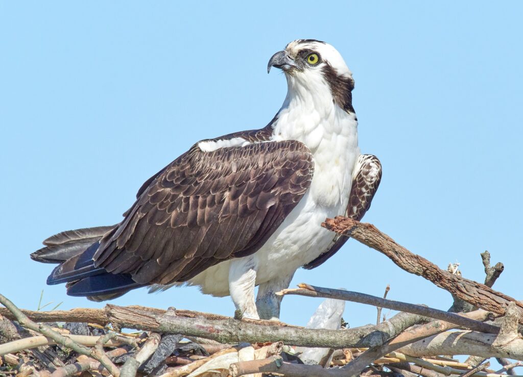
A close-up photo of an osprey standing on its nest. The osprey is a bird of prey with a sharp, hooked beak, yellow eyes, a white head and body, and brown wings. The nest is made of sticks.
A photo of the bay as seen from the end of the paved trail on the Jetty. A channel marker pole in the middle is circled, and an inset photo shows a closer view of the pole. The pole is topped with a flat platform, which holds a nest made of sticks. Below the platform is a sign that reads, “danger, submerged rocks, shallow area, keep out”. In the background, the San Mateo-Hayward Bridge is visible.
This pole makes a great spot for fishing and raising chicks. Osprey close-up by RoySmith via Wikimedia Commons (CC BY-SA 4.0)
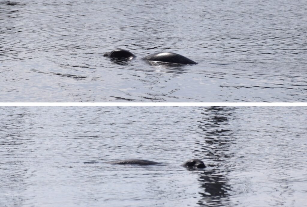
  • Boat ramp discoveries: The boat ramp near the Jetty is a great place to do “belly science” and peer at sponges, tunicates, and other small critters in the water. Keep an eye out for bigger ocean animals too, like harbor seals or bat rays.
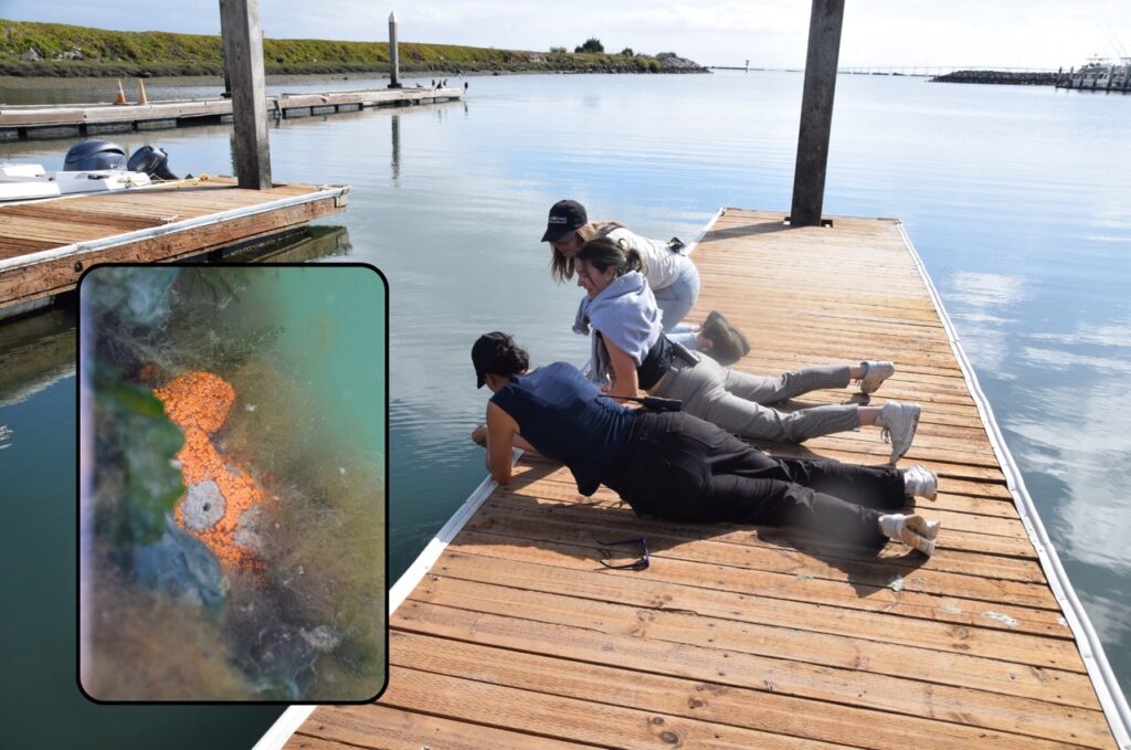
A photo of three people lying or kneeling on a wooden dock, looking down into the water on the left side of the dock. Two other docks stick out into the water, and the Jetty extends across the background. An inset photo shows a group of orange sea squirts nestled among some seaweed, attached to the edge of the dock.
Two photos of a gray harbor seal swimming in the Coyote Point marina. In one photo, the seal is facing to the left, and in the other, it’s swimming to the right and looking toward the camera.
We spent ages checking out all the bright orange sea squirts just below the waterline – so long that this seal snuck up behind us!

Jetty science:

  • Where do shells come from? Animals like snails, clams, and oysters build them out of a hard mineral called calcium carbonate and special proteins. When the animals die, their shells can wear down into sand, or they might stack up to build natural chalk or limestone. 
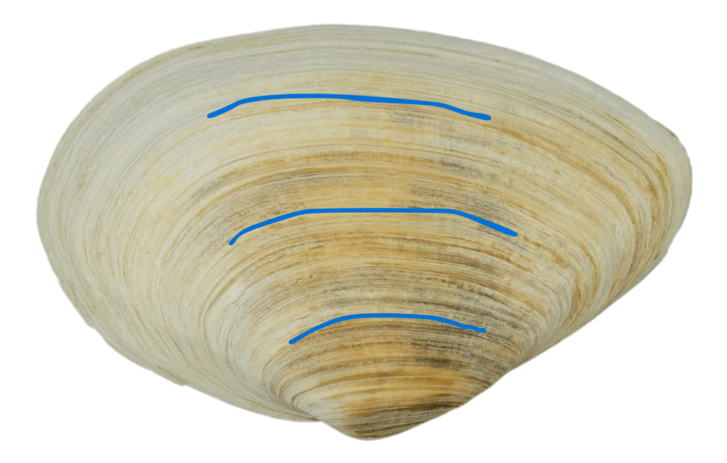
A photo of a clamshell with growth rings. Blue lines highlight some of the rings.
Scientists can calculate a clam’s age and learn about ocean conditions in the past by studying the rings in its shell (marked in blue). Photo by H. Zell via Wikimedia Commons (CC BY-SA 3.0)
  • When you stand on the jetty, you can feel the wind and see the waves moving from the northwest (near San Francisco) to the southeast (toward the inner Bay). When planes land at the nearby SFO Airport, they like to fly into the prevailing wind to keep their path stable. 
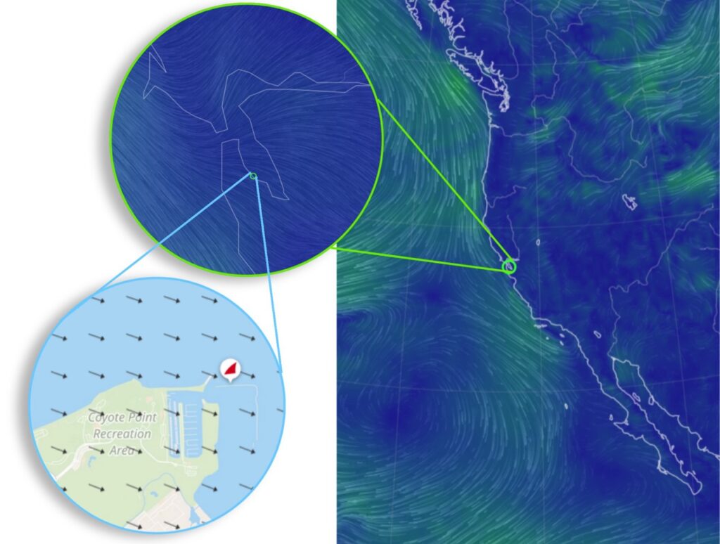
A map of the west coast of the US, all in blue, with thin green lines showing windflow across the coast. An inset shows the wind lines around the San Francisco Bay. Another inset points to the location of Coyote Point and shows a map of the park, with black arrows showing wind traveling from the northwest to the southeast.
The green lines and black arrows show wind flowing along the California coast, through the bay, and past Coyote Point. Images composited from https://earth.nullschool.net/ and https://www.windfinder.com/
  • Lots of plants grow near and on the Jetty, but not all of them belong here. Ice plant and fennel are invasive species that harm native plants, so park rangers are gradually working on removing them. Native plants around the jetty include California sea lavender and the golden poppy.
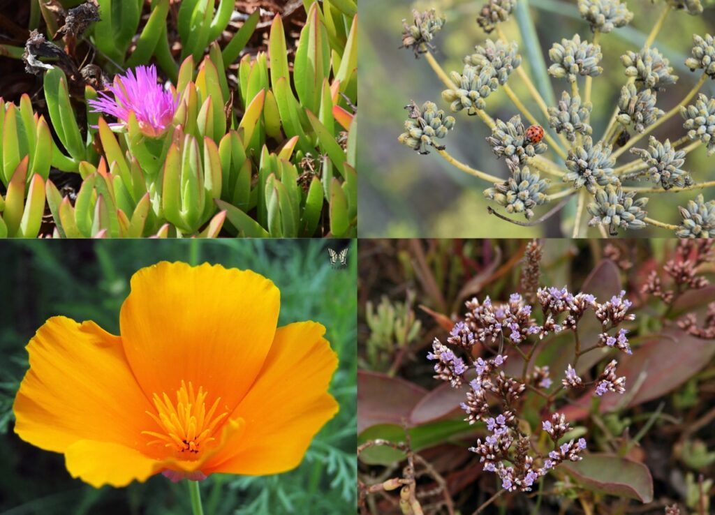
Four photos showing different plants. The top left photo shows ice plant, a succulent with thick green stems with red edges and a bright pink flower with many thin petals. The top right photo shows fennel, a plant with lots of thin stems and tiny green flowers, with a ladybug perched on one bunch of flowers. The bottom right photo shows California sea lavender, a plant with clusters of tiny purple flowers on thin brown stems. The bottom left photo shows California poppy, a bright yellowy-orange flower with large wide petals.
Clockwise from top left: Ice plant (invasive); Fennel (invasive); California sea lavender (native) by David A. Hofmann (Flickr, CC BY-NC-ND 2.0); California poppy (native) by Swallowtail Garden Seeds (Wikimedia Commons, CC BY 2.0)

Know before you go:

  • To get onto the shell beach, you have to climb over some boulders. The shortest and easiest route is right next to the sign at the end of the paving. (If you don’t want to climb, that’s okay! There’s plenty to enjoy from the path. Watch for sunbathing lizards among the boulders!)
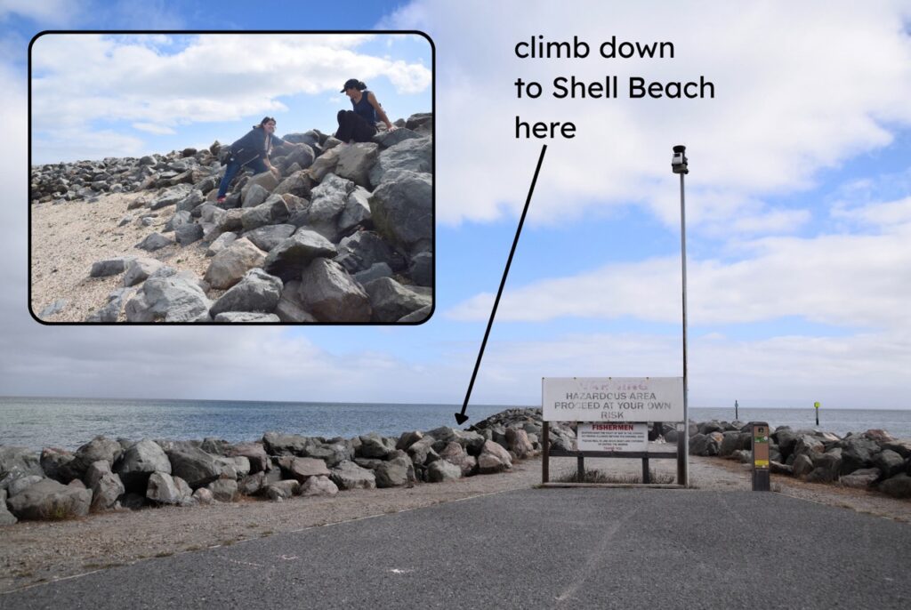
A photo of the end of the paved path of the Jetty, with boulders marking the edges on either side. At the end of the paving is a large sign that reads, “Warning, hazardous area, proceed at your own risk” in faded letters. There is a weather station pole next to the sign. Added text reads “climb down to Shell Beach here” with an arrow pointing to the boulders to the left of the sign. An inset photo shows two people climbing on boulders above the shell beach.
The easiest way to climb onto the shell beach is just behind this sign at the end of the paved path.
  • Because the Jetty sticks out into the Bay, the wind is usually much stronger there than it is up at CuriOdyssey. Extra layers can help you stay warm and comfortable. 
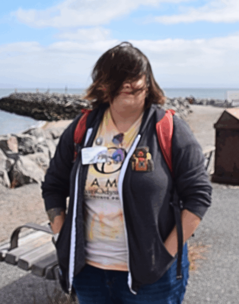
 A photo of Emma, wearing a jacket, standing on the Jetty. Their hair is blowing all over their face.
If you have long(ish) hair, a hair tie or scrunchie is essential.

Conclusion

While you’re exploring these special places, feel free to look, touch, listen, and smell. But when you’re done, please leave them as they are so others can enjoy them after you. Rocks, shells, bones, plants, animals, and other parts of nature should all stay here at Coyote Point. The Marsh, Rocky Beach, and Jetty will be waiting for you! 

Resources for exploring Coyote Point:

Join the CuriOdyssey Community

LOCATION

1651 Coyote Point Drive
San Mateo, CA 94401
Ohlone Land Acknowledgement
650-342-7755
info@curiodyssey.org

CuriOdyssey is a 501(c)(3) non-profit, Tax ID 94-1262434
AZA_Decals_Accredited_300px
ASTC_Member_red_300px
Scroll To Top